Monday 5/1/00 19 miles/1745 total. 109 trail days. SR 60 at Toomi Mountain to Springer Mountain to Three Forks.
It is not yet 8 AM, I have already flushed three wild turkeys and am standing on top of Tooni Mountain watching the sun usher in a beautiful day. This very special day deserved an early start; today is “Springer Mountain” day. Excited by the thought of finally arriving at the start of the Appalachian Trail, I am fairly flying south on the Benton MacKaye Trail. This is a bitter-sweet hike, the BMT is a beautiful, well maintained trail with very few hikers. I know that the solitude I have been enjoying will change when I reach the AT. At the base of Tooni Mountain a very well constructed suspension footbridge crosses the Toccoa River. The treadway is about four feet wide and the bridge must be at least 200 feet long and twenty feet above the river. This is a special piece of work not the type usually found on a hiking trail.
For several days we have been in the Chattahoochee National Forest. The plan today is that, after dropping me at my starting point, Betty will pick up Roger and they will drive to Three Forks, a trailhead on the AT. From there, they will hike four miles west on the AT to the top of Springer Mountain. Meanwhile, I will continue hiking down the BMT, which joins the AT near Three Forks, then I will hike west on the AT to meet Betty and Roger on Springer Mountain. This is the southern terminus of the 2160 mile Appalachian Trail; the starting place for all northbound AT thru-hikers.
As I hiked onto the AT, I felt as if I had been on a narrow remote country road and instantly I had turned onto an interstate highway. At this point the AT is about 10 feet wide; four people could easily hike side by side. During the first ten minutes on the AT, I saw more backpackers than I had seen during the entire hike from Key West (1756 miles). Previously, I seldom met other hikers and it was my habit to speak to them and stop for a short chat. This sometimes led to having lunch together on the trail or possibly inviting them to dinner at the RV, etc. It was quickly evident that even a brief exchange with everyone was not possible. At first I talked with anyone who seemed interested and let those with a tunnel vision glaze of determination keep moving. Also, some who really needed a break were laboring so hard with their heavy packs that they neither saw nor heard me.
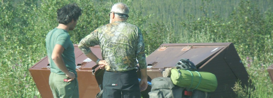
As I arrived on top of Springer (3782 feet), I found Betty and Roger seated on the large flat rocks near the two AT plaques. About a dozen other hikers were with them. We were all filled with the excitement of the moment. We spent an hour or two talking and taking pictures of hikers, the view, the plaques and hikers in front of the view or the plaques. Everyone signed in on the notebook that served as a trail register. Nearly all of these hikers had arrived here by hiking up from Amicoloa Falls State park, which is the traditional route. As we all talked and rested, new arrivals would join the group. Eventually, a lone hiker, or two, or three would don their packs and wave to the rest as they started their own personal journey. Many had indicated this was the greatest commitment or challenge that they had ever undertaken. Most, but not everyone, was embarking on a two thousand mile trek to Maine. Some were on short hiking vacations and were dreaming of a time when they could “do the trail”. Soon, we felt it was our turn and Betty led the way back down the AT retracing our way back to Three Forks.
On the way down we met “Spider”. He said he had to get back to civilization to get some money and some equipment. Without thinking, I offered him a ride; not a wise decision. This guy was different; his stories did not coincide with the facts, as we knew them, his clothing and equipment looked more like that of a bum than a hiker, plus he smelled. His was not the pleasant sweet odor a backpacker sports after a day on the trail, but rather the malodorous reek of many days and nights in the same clothes without washing.. Anyway, we drove the guy to Blue Ridge and listened to his tales of woe and wander.
Spider and other distractions aside, it was a special day for all of us.
Betty: Roger and I had a great hike onto Springer from Three Forks. It was a beautiful day. When we first arrived at Three Forks, we met Warren Doyle, who is supporting an expedition of hikers (about 17,
I think). He evidently supports an expedition of hikers every five years. Also, we were told that hikers have to qualify to be a part of his expedition. As we hiked up the trail, we met 18 hikers between Three Forks and Springer. I couldn’t believe it. It was a beautiful day, a wonderful hike, and we enjoyed it very much.
It should be noted that Roger now has a trail name, “Boca Pete”. He lives in a housing area called Boca Palms and his grandfather always called him Pete, for some unknown reason. Our little trio of traveling hikers now consists of: “Boca Pete”, “Honeycomb” and “Swamp Eagle”. “Natty Bumpo” and “Crabby Trails” are currently missing the action.
Tuesday 5/2/00 16 miles/1761 total. 110 trail days. Three Forks to Woody Gap.
Roger and I started at Three Forks. This area did not have nearly as much hiker traffic as we saw yesterday afternoon. We were over Hawk Mountain and through Hightower Gap quickly. When we started up Sassafras Mountain the trail became steeper and our pace slowed. Dave and his beagle, Nelson, were enjoying a leisure pace. Nelson carried a pack with a week’s supply of chow. During lunch, Roger decided to take his time getting to the road at Gooch Gap, while I hiked on to Woody Gap to meet Betty. Betty and I would then drive back to Gooch Gap and pick up Roger. It was a smart plan, the 12 miles to Gooch Gap were more than enough for his second day on a mountainous trail.
Along the way, I ran into “One Way”, whom we had met yesterday. He was just finishing a mid-afternoon break. We seemed to hike at about the same speed, so we walked and talked over the hills and into Woody Gap. It is only fair to note that “One Way”, like most hikers on the AT, was carrying a full pack with tent, sleeping bag, food, stove, etc. His pack probably weighed in at about 40 lbs; mine was about 12 lbs. He was the fastest “full pack” hiker I have seen in my two days on the AT. I arrived at Woody Gap over an hour ahead of schedule. After about 30 minutes “Fool Injected” arrived, I had met him yesterday as I ate lunch. We had talked as I ate a sandwich; I asked if he wanted my second sandwich. He said “Oh no, I couldn’t eat your food”, as he reached out for the sandwich.
The next arrival was a pick-up truck. The driver, an older man with long gray hair and a long beard got out and stood in front of our little group for a minute, then called me by name. It was the legendary “Nimblewill Nomad”. Betty had phoned him earlier in the afternoon to arrange a meeting and they decided Woody Gap was the best place. Both Betty and I had corresponded with “Nomad” via email and
had talked with him by phone, but this was our first meeting. Two years ago “Nomad” did a Key West to Canada hike similar to the one I am attempting. He had given me some good suggestions when I talked with him last December.
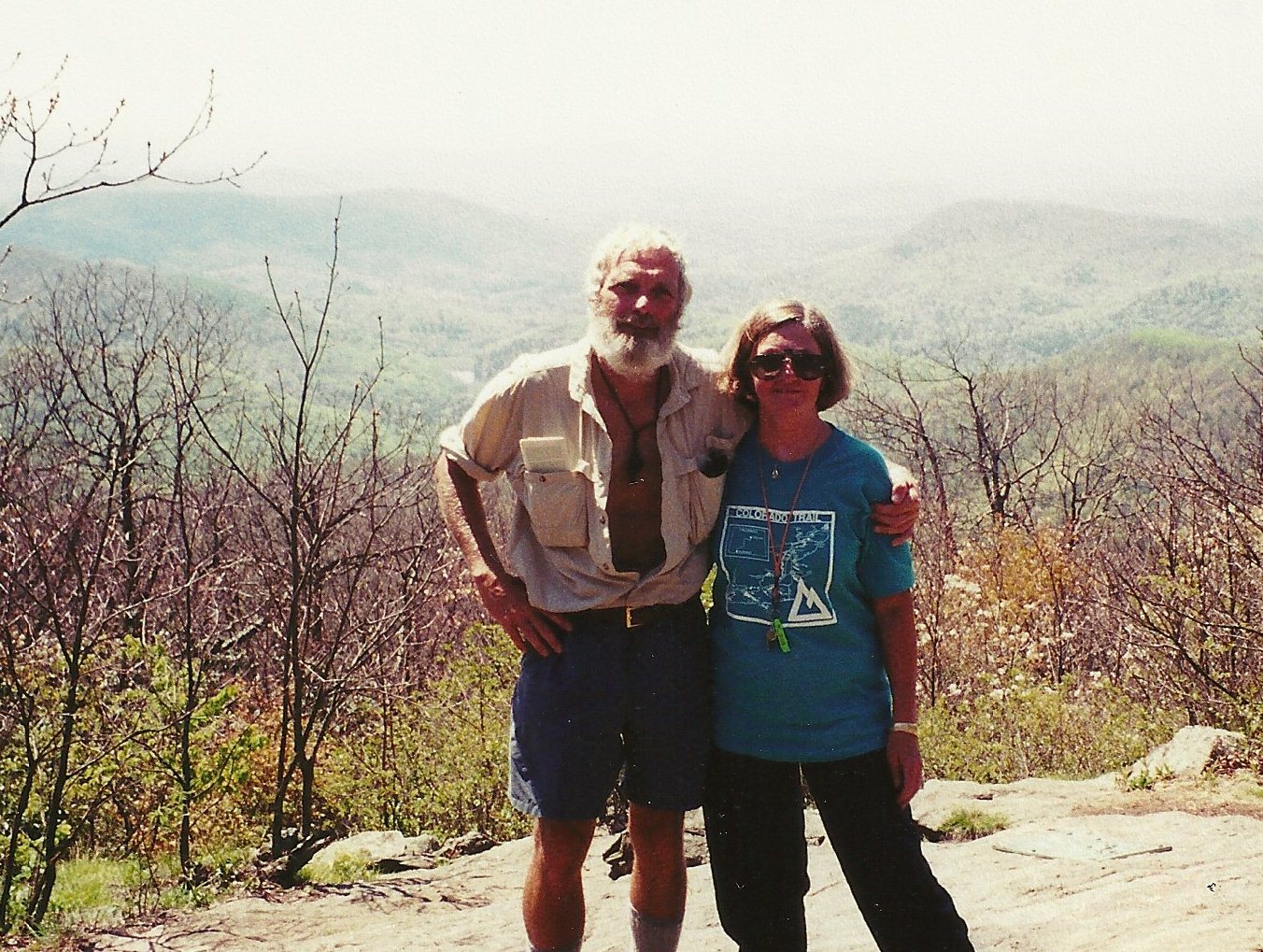
As we talked, Betty arrived and “Nomad” met her as she stepped out of the car. They embraced like old friends. “Nomad” passed around a box of snickers, as if he knew it was one of Betty’s favorite candy bars. We talked about the routes that each of us had hiked to connect the major trails (Florida Trail, Pinhoti, Benton MacKaye and Appalachian). It was most interesting to share information about mutual friends who were currently thru-hiking the Trail. “Nomad” gave us some of the details about his Canada to Key West hike starting in about three weeks. He encouraged us to attend “Trail Days” in Damascus, VA on 19-21 May. We told him we would try to be there to hear his presentation.
Like all great and wonderful times, this too came to an end. “Nomad” drove off and we offered “One Way” a ride back to his cabin. We picked up Roger, who had been waiting at Gooch Gap and returned to the RV after another great day on the Trail.
Wednesday 5/3/00 17 miles/1778 total. 111 trail days. Woody Gap to Hogpen Gap.
Betty and Roger deposited me at Woody Gap. The plan was for them to leave our vehicle at Hogpen Gap, the day’s ending point. They would then drive Roger’s vehicle to Neel’s Gap and start hiking from Neel’s Gap to Hogpen Gap. The plan worked well.
The Walasi-yi Center at Neel’s Gap is quite interesting. I talked for several minutes with Dorothy. She and her husband, Jeff, have operated this hiking supply store for 17 years. She remembered meeting our friend, Jan Curran, when he was there on his thru-hike 12 years ago. Jan’s most recent book, “Onward to Katahdin” is selling well, she said. While browsing through the camping and hiking gear in their store, I met “Spider” again. He said he has been partying and has not slept since we saw him two days ago. Also, he informed me his new trail name is “Whatever”. I told him I thought it was a good choice.
Along the way, I met Thea, an Australian lady who came to the United States just to hike the AT. “Fool Injected” and I hiked together for a few miles. We talked about the works of Robert Service and Jack London, which we both like, during the long haul over Blood Mountain (4461 feet) the highest point so far on the trail.
Betty: This morning we moved the RV from Whispering Pines to a gas station just north of where we would be hiking the Trail. In the afternoon we moved the RV on to Bald Mountain RV Park in Hiawassee. We will stay in Hiawassee for about three days while we hike north toward North Carolina.
Roger and I started our hike at Neel’s Gap. We went in to check out the store before heading up the trail, and you guessed it, we ran into “Spider”. He had linked up with his buddies. I was a bit concerned as Roger and I headed up the trail and into the mountains, however, a family of three (the Culbertsons)
headed up behind us which made me a little less anxious. We had a wonderful hike and saw many beautiful flowers along the way. Some of the most notable being numerous Trillium and Bluets. The weather started off a bit threatening, but was great hiking weather. Cool and a little overcast.
Thursday 5/4/00 14 miles/1792 total. 112 Trail Days. Hogpen Gap to Unicoi Gap.
During the night it rained hard for several hours. By dawn the rain had stopped, but it was foggy. Roger drove me to the Trail. My starting point is at about 3500 feet elevation and the fog was so thick, visibility was limited to about 20 feet. Just after starting up the Trail, I heard a female voice off to my right; “Swamp Eagle, is that you”? I stepped off to the side of the pathway to find a tarp stretched over the Culbertson family. We had passed them yesterday. They are from Kentucky and are spending their vacation on the AT. Even though “pack sore” and plagued with blisters they are having a good time. Mr. Culbertson has a heavy duty hiking stick made from a tobacco stick from his grandfather’s farm.
On the climb up Poor Mountain, I flushed a wild turkey. Due to the fog, I could only hear it depart. Hiking on a well marked trail in a heavy fog gives me a feeling of moving along in my own little bubble.
There are often other trails that intersect the AT , so I try to watch carefully for the white rectangular blazes that mark the AT. Side trails are marked with blue rectangular blazes and may lead to a shelter, a water source or connect with some other trail or location.
With the sun obscured by fog, the day remains cool and hiking is quite comfortable. From the tracks on the trail, I know that I am following a hiker with big boots, maybe size 13 or larger, and he is using two hiking sticks. Even though I know someone is in front of me, I see no other hikers on the trail today. I think I am starting to like the AT. The trail traffic the first two days was more like a walk in Central Park than a wilderness experience. Upon arrival at Unicoi Gap Trailhead, I met “Viking Fork” a big burly guy with a heavy beard and long curly hair. He was waiting for a shuttle ride into town to pick up supplies.
Betty and Roger picked me up and we drove to the nearby town of Helen, GA. The entire little town has the architecture and atmosphere of a German Village in Bavaria. We ate at the Alt Heidelberg Restaurant; it was great.
Betty: I spent the day catching up the journal, laundry and other chores that have been waiting. The park we are staying in is also hosting a BMW motorcycle rally. About 500 BMW owners are here with their bikes. Pretty interesting. We’re told the motorcycle riders really like riding in the mountains in the spring and we see lots of evidence that that’s true.
When I drove to Dahlonega a few days ago on a scouting mission, I found a brochure about Alpine Helen. It said Helen has a population of 300, but is able to handle up to 3,000 visitors a day. It was a lumber mill town that was nearly deserted by 1969. A very wise business man realized that the town had a captive audience driving through it, as they were sightseeing in the mountains, and the town needed a way to get these visitors to stop. He, with the help of other locals and entrepreneurs, decided to remodel Helen to resemble an Alpine village. They did a great job. It has the feel of stepping into a village in Bavaria. Fortunately, we are ahead of the tourist season. The shops were fascinating and the food delicious.
Friday 5/5/00 16 miles/1808 total. 113 trail days. Unicoi Gap to Dicks Creek Gap (US 76).
Roger and I were at Unicoi Gap before 8AM. The plan of the day was that I would hike the 16 miles to Dicks Creek Gap and Roger would hike a couple of hours then hike back to his van. He then would drive around to Dicks Creek Gap to pick me up when I finished for the day. It all worked well, the weather was great and the trail was not too difficult. I was over Rocky Mountain and through Indian Grave Gap so quickly that I passed the side trail to the old Cheese Factory site. Evidently there was a well known dairy that made cheese back in these mountains in the mid 1800s. The trail led over Tray Mountain at almost 4500 feet, through Blue Ridge Swag and over Kelly Knob and Powell Mountain before descending into Dicks Creek Gap where I would meet Roger. The hot afternoon sun slowed my pace some; it also took the sparkle out of some of the mountain wildflowers. All during our hike in Georgia the trails have been lined with beautiful mountain wildflowers; crested dwarf iris, wild violets, bluets, and many variations of daisy. Some of my favorites are trilliums and fire azaleas.
Saturday 5/6/00 16 miles/1824 total. 114 trail days. Dicks Creek Gap, GA to Deep Gap, NC.
As I started off toward Deep Gap, NC, Betty and Roger set off behind me to hike a few hours, check out some of the natural sites along the trail and return to the vehicle.
On the way up to Bly Gap, which is on the Georgia/North Carolina border, I overtook a local group of seven day hikers. They are from Hiawassee and they hike nearly every weekend. At Bly Gap, three horseback riders were crossing the AT on another trail. I stopped to talk with them about riding mountain trails and the local area. They were a friendly bunch. As they departed up a steep slope, I envied their easier mode of travel.
Across Courthouse Bald, through Muskrat Creek and on to Deep Gap, Roger was waiting. He had just met the AT legend, Wayne Doyle, who is leading and supporting a group of 15 thru-hikers. Betty and Roger met Wayne the day they hiked up Springer Mountain. Wayne’s group is one day ahead of us and moving at about the same rate each day. I have not yet met Wayne, but have read about him and seen him on a video. He heads the Appalachian Research Center (or something similar) and leads/supports thru-hikers every few years. I have heard that this is his 13th time to thru-hike the AT. A few years ago when he “only” had done the deed nine times, I heard that it was more than any other person, sane or otherwise. I hope to meet him before they pull away from us.
Betty: We, once again, moved the RV to a gas station and after our day of hiking, moved it on to our next site, Cartoogechaye Creek Campground near Franklin, NC. I mentioned earlier that I would report back on the Passport American membership. Well, our last campground and this one are members and we have now paid for our membership and saved additional money, so I feel it was a good deal. Both also have computer access, although I didn’t have time to use the one at Bald Mountain.
Roger and I had a great hike. The weather was nice, although it’s starting to get a little warm by mid morning. We hiked about 6 miles round trip. We saw flame azaleas, which are beautiful, and also some wild violets and daisies, but we didn’t see any trillium today and they are really the most beautiful. Roger got a schedule from Warren Doyle. His hikers are starting out about the same pace as we have scheduled, but will soon be doing many 20+ mile days. They have a very aggressive schedule with no rest days scheduled until August. According to their schedule, they plan to be at Mt. Katahdin by September 2nd, and we’re hoping to get there toward the end of September. We wish them luck.
Sunday 5/7/00 21 miles/1845 total. 115 trail days. Deep Gap, NC to Rock Gap.
It was a long gentle climb up Standing Indian Mountain. In two and a half miles the trail rose 1000 feet to the summit at 5499 feet. I was on top by 8:30 AM, the morning air was cool but, as I got up a head of steam, I rolled up my long sleeves and unbuttoned the from of my shirt. The long gradual descent of 1200 feet into Coleman Gap was five miles and took almost two hours.
It was a fine day for hiking and I met or passed about 50 other hikers who agreed. Some were just out for a Sunday walk in the mountains, but most were carrying big new packs for a few nights in this beautiful backcountry. A Girl Scout group, a church group, a three generation family of seven’ all heading to or returning from the North Carolina Wilderness. Many were taking the young children, but I talked with three women who were there to get away from kids and schedules and household duties.
The climb up Albert Mountain was steep but short. At the top I met two young women who were enjoying a magnificent view. They seemingly had the whole world spread out before them. In a few days they both would be graduating from Clemson University and they would be going their separate ways in life. Joanie, a Parks and Recreation major, had a job in Australia and Amanda would remain at Clemson for graduate school in civil engineering. I ate lunch as we talked and I could sense the bittersweet nature of what might be the last outing two best fiends might have together. We talked about lots of things and I remembered how, like them, I was unsure of the future at that age, but still eager to get on with it. I would have liked to stay and pass along all sorts of fatherly advice, but I knew they wanted to spend the special last hours privately. I gave them our website address and they promised to check in with us.
The long descent to Rock Gap, the ending point for the day, went quickly. I thought of our daughter, Susan, when she was about the age of the two girls from Clemson. It is only a flash of time between the point at which the whole world is at your feet to the time when you are locked into the fabric of life. In what seems little more than an instant our daughter went from an exciting school girl to a wife and the mother of three fine sons.
The last two miles of today’s hike were spent hiking along with John Newman, “Oliver Twist” and Jeanine. They are members of the Nantahala Appalachian Trail Club and were checking their portion of the Trail to determine what maintenance was required. We were all moving at a brisk pace and talking about local trail issues. We were at the trailhead almost before I was ready to stop for the day.
Roger arrived a few minutes later. He had hiked up Standing Indian Mountain earlier this morning, we compared notes as we drove back to meet Betty at the RV.
Monday 5/8/00 14 miles/1859 total. 116 Trail Days. Rock Gap to Wayah Bald.
Roger and I got an early start; we were moving up the trail from Rock Gap shortly after 7AM. It was pleasant; hiking on a cool morning with the sun rising over the ridgeline to the east. We spotted a new arrival on the wildflower scene; a dark maroon trillium. A few of these little beauties were unfolding. Roger planned to hike beyond Winding Stairs to a waterfall then return to the van. He would then drive around to Wayah Bald to get me.
The cool air made it easy to knock out the miles. I passed a few hikers having coffee by their tent. On my way up Wine Spring Bald, I met “June Bug”, a lady about sixty. She planned to thru-hike to Maine. She said if it looked like she would not make it before October 15th, she would “flip flop” (hiker jargon meaning to stop hiking short of your destination and drive or fly to the destination then hike back to the point where you had stopped hiking earlier). This is an accepted thru-hiking technique, but it is usually a last resort and seldom planned at the start of a trek.
I arrived at Wayah Bald before Roger and rested under a shady oak tree to have lunch when a car arrived with two couples. They invited me to have lunch with them but I declined. One of the gentlemen brought me an apple and some carrots. They were the Stephensons from Franklin, NC and their guests, the Culverts from Orlando, FL.
On Roger’s drive up the mountain he gave two thru-hikers and their dog a ride up the steep road. Apparently, these two have a more liberal set of standards for their hike than that of most thru-hikers. And, that is OK; there are no rules governing such actions other than those each individual sets for himself. Each person must hike his own hike. “Bluefoot” and his German Shepherd looking dog “Timber”, were from New Jersey. “Bluefoot” and “Handyman” appeared to be having a good time.
Since Roger and I returned early, Betty suggested we all drive up to Nantahala Outdoor Center (tomorrow’s destination) to get some hiking equipment and find a new place for the RV. A good Mexican meal on the way back topped off a great day.
Tuesday 5/9/00 17 miles/1876 total. 117 Trail Days. Wayah Bald to Nantahala Outdoor Center on US 19.
The three of us (Betty, Roger and I) were standing at the top of an observation tower at Wayah Bald watching the beginning of a beautiful day. The sun’s rays looked like long shafts reaching down into the many valleys of the mountains spread out for miles before us.
Betty and Roger drove back down Wayah Bald to move the RV forward. The first miles of the trail went by quickly. About noon, I met “Handyman” having lunch and joined him. He was nursing some sore feet. He said he loved hiking and the mountains, and there were only two things about mountain hiking that he didn’t like; going up and going down. As I was departing, eight college students arrived, I had passed them earlier. One of the girls had been at the Phish Concert at the Big Cypress Indian Reservation in South Florida. I had hiked by that same site two days after the concert near the start of this hike last January.
The afternoons hike had some of the most spectacular views we have seen on this trip. At one point I could see Fontana Lake and across the Great Smoky Mountains National Park. The last few hours the trail steadily descended into the Nantahala Valley, losing about 3000 feet. The Nantahala Outdoor Center is a beehive of outdoor activity; whitewater rafting, kayaking, mountain and road biking, camping, climbing and hiking. I could hang out at a place like this for a long time. We had dinner at their Relia’s Garden Restaurant; good meal in a great setting.
Betty: As Roger and I were leaving the top of Wayah Bald, a bobcat crossed the road in front of the car. It was exciting having a bobcat to add to our list of “neat things we’ve seen in the wild”. After leaving the observation tower and Wayah Bald behind, we drove back into Franklin to shuttle forward. Roger drove the RV and I drove the Honda, we parked the RV in Hide Away Campground in Bryson City, NC right on the edge of the Great Smoky Mountain National Park. The campground managers, Roxine and Charles, have been very accommodating and we have a wonderful pull through spot, plus we are able to use the phone line to update our website. We went back to Franklin to pick up Roger’s van. The mountain roads are slow going up and the RV really labors when it’s towing the Honda, so we opted for the less strenuous (for the RV) way. We put on over 200 miles by the end of the day. After getting Roger’s van, it was time to head to Nantahala to pick up Chuck. The Nantahala Outdoor Center has some wonderful shopping. They have everything you could want in gear. I think we now own a share of it. While at Nantahala, both Roger and I (at different times) ran into Warren Doyle (leader of the expedition). He said to me, “I wish you guys would hurry and catch up”. We have been one day behind him from the start on the AT. His hikers are doing about the same mileage as “Swamp Eagle”, but that means that if we really were going to entertain catching up, “Swamp Eagle” would have to add additional mileage. I don’t know if that’s a good idea since we have a pretty sensible schedule. Chuck will be at Fontana Dam on Thursday and will start into the Great Smoky Mountains National Park on Friday. Originally, we thought it would take about seven days hiking through the park and that there was only one access point along the 71 miles, however, we have since realized that there are a couple access points, and Chuck’s mileages have been increasing, so he may be able to make it through in about five days. The mountains are tremendously high and the climbs are reportedly strenuous. So, we’ll just see how it goes. We will move the RV to the eastern edge of the park, and where Chuck will depart the park. I will make support runs from there.
Roger, “Boca Pete”, is leaving in the morning to go to Charlotte, NC to help celebrate his wife Carol’s birthday, Mother’s Day, and Cheryl’s (their daughter) birthday. Happy Birthday, Carol and Cheryl. I know they’ll have a great reunion. Roger has had some trouble with his knee, so he hasn’t been able to hike the miles he would have liked. He’s gone on several hikes and I’ve accompanied him on some of them. He’s also been helping with the support – picking up Chuck and dropping him off. He’s going to have his knee checked and we hope he’ll be back on the trail soon.
Wednesday 5/10/00 Just talked to “Crabby Trails”, Mae, who will be joining us tomorrow. She’ll be helping make those support runs. No doubt we’ll find some neat things to do while Chuck’s on his trek through the park. While Roger and I were preparing to move the RV forward yesterday, a lady backed into me and my trusty Honda CRV, in the K-Mart parking lot. She was in a pickup with a load of hay and couldn’t see out the back window and failed to realize that I was behind her. Not too bad, as she was going very slowly and I was stopped by the time she hit me. She does have insurance and that’s a plus, but I don’t need the extra job of working out things like that.
Back to the journal:
Wednesday 5/10/00 21 miles/1897 total. 118 Trail Days. Nantahala Outdoor Center to Yellow Creek Gap.
Roger departed for Charlotte, NC to celebrate birthdays and Mother’s Day with his family. Betty drove me to the Nantahala Outdoor Center. As I hiked north up the steep incline out of the Nantahala Gorge, I thought of our dinner last evening in this beautiful valley. After dinner we had met “Shake” from New Hampshire and “Path Rocker”, both are attempting thru-hikes and we had a lot in common.
Earlier this morning it rained and the trail was damp and soft and quiet. Lots of birds were singing. By mid-morning I overtook “June Bug”. We had never met, but each of us knew who the other was; the “trail telegraph” at work. Both Betty and Roger had met “Bunny”, plus “Handyman” told me yesterday that I should be catching up with her. “Bunny” is from Salt Lake City; a young hiker compared to most of us and not shy. She seems to feel very “at home” on the Trail. Her hydrating system (water bag with a hose so a hiker can drink on the move) was not tightly capped and nearly all her water was lost. I gave her a spare quart that I had in my pack. “Bunny” stopped at Grassy Gap to fill her water containers. I continued up the long and sometimes steep slope to Cheoah Bald. It was time for lunch when I reached the summit. It was a great view across the bald, a large “field like” grassy area.
Our revised plan was to hike the 14 miles we had planned for today plus seven more miles, so that tomorrow would be a short hiking day. We want to move the RV to the north end of the Great Smoky Mountain National Park.
The last few miles seemed to drag, plus I was out of water. Several of the possible water sources shown on my map were off the trail a greater distance than I wanted to walk. About three miles from the day’s ending point, I heard a trickle of water splashing in a small pool a few feet above the trail. Clear cool water was coming out of the ground and dripping from a rock. It took about three minutes to fill my water container (a one liter plastic Pepsi bottle). It was wonderful.
Betty was waiting when I got to Yellow Creek Gap.
Betty: As I was waiting for Chuck at Yellow Creek Gap, a hiker appeared on the scene, it was “MarVetKo” (stands for Marine Veteran Korea). We started talking and he said “Do you mind if I just take this pack off for a while”? He would soon be heading for the shelter that was .9 miles up the trail. MarVetKo is a Swede who hails from Watertown, Wisconsin. We exchanged many tales of Swedish/Norwegian tradition that we love. MarVetKo was hiking with two trekking poles and told about how he came to have those. Seems he was hiking with a favored hiking stick and after leaving Neels Gap, where he had very little sleep because of noise from neighbors and traffic, he was coming down a steep slope and tripped on a rock. He landed on another rock, which cut a gash in his head. As he was trying to determine if everything was still in working order, and picking himself up off the rock, three hikers came down the trail. They helped him get his wound cleaned and closed with a band-aide suture. The three were a father, son and friend from New York. They hiked with him about three days to make sure he was doing OK. Upon their departure they made sure he had the trekking poles he needed for a safe journey – making him a deal he couldn’t refuse. They also offered to take his hiking stick and drop it at his home later in the year. What nice folks you meet on the trail!! MarVetKo will be leaving the trail tomorrow and taking a few days off to attend a class reunion in St. Louis. As we were chatting, two more hikers ambled by and on up the trail. Soon it was time for MarVetKo to don his pack and set off up the trail. A short time later, about 6:30, Swamp Eagle finished his day and we were heading back to the RV.
Thursday 5/11/00 8 miles/1905 total. 119 Trail Days. Yellow Creek Gap to Fontana Dam Visitors Center.
Today we planned to hike in the morning and move the RV to the north end of the Great Smoky Mountains National Park in the afternoon.
It was another great morning on the trail. At the first shelter I met “MarVetKo” and “Tree Hopper”. Yesterday Betty and “MarVetKo” had met when she was waiting to pick me up at the Yellow Creek Gap Trailhead. The only other hikers I met were Scott Acreage and “Tripper”. They are”section hiking”. Unfortunately, after talking with them I left my wayward hiking stick leaning against a limb. I was a half mile down the trail before I realized it was again “missing in action”. That little trip back to retrieve it cost me an extra mile.
At Fontana Dam Betty had met “Many Sleeps”, a 1998 thru-hiker with a long white beard. He works at the visitors center. Also, we met Pam who is now driving the shuttle van for the Warren Doyle crew.
We moved the RV to a site near Cosby, TN. Mae, “Crabby Trails”, and “Susannah”, her Boston Terrier, arrived as we were hooking up the rig.
Betty: “Many Sleeps” is a Maine transplant to South Carolina. He is an AT volunteer who comes to Fontana Dam to keep track of how many thru-hikers are entering the Great Smoky Mountains National Park. He makes sure they have the information they need. He told me that 1142 thru-hikers had entered this year. While he and I were chatting, “Phalafer” came up and asked “Many Sleeps” how far he would have to hike to get a big breakfast. “Phalafer” was one of the hikers that came through Yellow Creek Gap yesterday when I was waiting for Chuck. Since it would be a while before Swamp Eagle arrived, I offered to give him a ride to Fontana Village and he could take the shuttle back after his breakfast break. When he got in the car, he immediately rolled the window down and apologized for his ripe hiker smell. Upon my return to Fontana Dam, Levi and I hiked around the area and waited for Chuck to finish his trek.
Friday 5/12/00 “Crabby Trails” and I dropped “Swamp Eagle” at Fontana Dam to begin his 71 mile trek across the Great Smoky Mountains National Park. We will meet him with a resupply on Saturday near Clingman’s Dome in the middle of the Park.
As you gaze over the Smoky Mountains you can see the smoke like haze that gives them their name. The park is in both North Carolina and Tennessee and covers an area more than 520,000 acres. Highway 441 bisects the park and is the road we will use to meet Chuck halfway through his journey from the south western border to the northeastern border of the park.
Friday 5/12/00 15 miles/1920 total. 120 Trail Days. Fontana Dam to Spence Field Shelter in the Great Smoky Mountains National Park.
It was a long drive from the new RV site at the North Eastern end of the Great Smoky Mountains National Park (GSMNP) back to the South Western corner to start the day’s hike at Fontana Dam. We met “Sheephead Joe” in the parking area. He hiked with Betty, Mae and I as we crossed the Dam at 10AM. After crossing, we all got some pictures and “Sheephead Joe” and I hiked on into the Great Smokies as Betty and Mae returned to the car. “Joe” and I talked as we hiked up and up. We stopped for lunch at Birch Spring, I hiked on when “Joe” went to refill his water containers. It was a hot day, some said 92 degrees. We were constantly climbing on the steep trail so progress was slow. It was late afternoon and I was still a half mile from Spence shelter when I heard something thrashing loudly through the underbrush. About 50 feet in front of me a large black bear crossed the trail moving to my left front at full speed. I could not get my camera out in time to snap a picture, I waited to see if a second bear would follow, but not.
When I arrived at Spence Field Shelter there were many tents around the shelter. I picked an almost level site and pitched my tarp in a “lean-to with floor” fashion. This was the first time I had tried to cook with the little Esbit stove and fuel tablets. The Fettuccine with Alfredo sauce was great. The fuel tablet expired at the “al dente” stage.
After dinner, I put all my food including snacks plus a ziplock bag of trash into one nylon bag. It is a Park requirement to “bear bag” all food for the night. The bag then is hooked onto a cable that is pulled up about 20 feet to be out of any bear’s way.
The night was warm, but a stiff breeze made for good sleeping.
Saturday 5/13/00 22 miles/1944 total. 121 Trail Days. Spence Field Shelter to Newfound Gap at US 441.
It was a pleasant night and I was up early. Just as I was leaving camp, “Sheephead Joe” slipped out of his tent and Colin stepped out of the shelter rubbing his eyes. I love the trail early when both the day and I are fresh. I stopped near Derrick Knob for a bite of breakfast. Two deer eased out of the woodline and grazed in an open area near me; got several good pictures. Later, I stumbled across “Phalafer” resting with his long legs stretched across the trail. A young, laid-back guy from Bardstown, Kentucky, “Phalafer” just takes trail life easy. He had seen “Spider” aka “Whatever”, back at the Nantahala Outdoor Center hitting some folks up for a handout so that he could get back on the trail.
On a ridge with steep slopes falling from both sides of the narrow trail, it was difficult to find a wide spot for lunch. Finally, I found a weedy place and sat down for a break. This darn spot must have been loaded with chiggers, before evening I had about a hundred bites from the little critters. As usual, they don’t really bother me, but they are a nuisance.
Betty and Mae were waiting for me at Clingman’s Dome (elevation 6644 ft), they had brought a box with a great tasting cold pizza. They took my pack back to the car and gave me instructions to hustle on down the trail to quickly knock out the eight miles to the trailhead at Newfound Gap and US 441. It had been a hard day and there wasn’t much zip in the home stretch that would bring the day’s total to 22 miles.
Mae’s Note: (Mother’s Day) There is no doubt about it – these Smoky Mountains have a firm grasp on my heart. It is such a beautiful area – the huge trees, fresh mountain air and clear streams by the roadside, with colorful wildflowers that I rely on Betty to identify. I am in constant awe of this country. Betty and I hiked up to Clingman’s Dome yesterday with Levi and Susannah to meet Chuck and replenish his supplies. Betty and I had eaten lunch at a Pizza Hut in Gatlinburg on the way. As always, Betty was thinking ahead and knowing just the right thing to do. She ordered a small pizza to take to Chuck. He was surprised and grateful when he was presented his cool pizza. The views were outstanding from Clingman’s Dome, the highest point on the AT before reaching Mt. Washington in the White Mountains. The Fox Den RV Park in Cosby, TN, where the RV is parked now, is a peaceful and beautiful place to spend a few days while enjoying nature’s splendor and the great company of the finest sister-in-law in the world!! Susannah continues to grow everyday and has now earned the trail name “Pees Happy”.
Betty: As Mae and I were visiting with Chuck while he ate his pizza at Clingman’s Dome, I took some movies and we talked a little about the trail. Then when she and I hiked back down to the parking lot, we took some more movies of the beautiful vistas and the narration included some of Swamp Eagles recent quests. As I was finishing up, a man next to me said “How far has he gone”? It was Bob Waters. He had seen us up at Clingman’s Dome and then again in the parking lot. He was also trying to capture the beautiful views. He told me he and his wife, Meg, are interested in hiking the AT when they have more time. He is a Professor of Neurobiology at the Health Science Center of the University of Tennessee, Memphis. We exchanged cards/information. I love the fact that we meet so many interesting people along the trail. So many of them we hope to see again and wish it were possible to spend more time with them.
Sunday 5/14/00 15 miles/1959 total. 122 Trail Days. Newfound Gap (US 441) to TriCorner Knob Shelter.
The morning was cold and windy as Betty and Mae let me out at Newfound Gap parking area. I wore a fleece jacket as I started up the climb to Icewater Spring. Soon the heat of the rising sun and the heat of the climb found me with no jacket, shirt sleeves rolled high, and the front of shirt unbuttoned to the waist.
Just across from Icewater Spring Shelter was a lone, faded tent. This was the oldest most beat up (used)model of Sierra Design’s “Flashlite” that I have seen. The long facing material that normally holds the door zipper to the tent was blowing in the breeze and the fly (waterproof cover) had worn through in many places. This tent had seen a lot of trail time. I said “good morning” as I passed by a few feet away on the trail. A raspy voice managed a strained “who is it, wait a minute”. Out of the old tent came an old bearded guy. “Damn”, he said, “I never used to sleep until ten, must have been the liquor”. It was “Not Too Vicious”, a bit of a legend of days past on the Trail. He thru-hiked several times in the eighties and now he likes to hang out on some of his favorite sections. His clothing was once the best made, but now is thread bare and full of holes and patches. He offered me a cup of coffee and we talked about the Trail. He was a kind old guy and “Not Too Vicious”.
It was a crystal clear day with stunning views. The trail narrowed to about a foot wide with a sheer vertical drop of several hundred feet on one side and a wall straight up on the other side. This beautiful area called “Charlie’s Bunion” is the most stunning part of the Trail to this point.
The Trail has been following the North Carolina/Tennessee border through the Great Smoky Mountains National park. Mostly tracing over mountain peaks, ridges, and gaps, it is continually climbing and descending. About one-half of the hikers are thru-hikers, others include weekenders and hikers “doing the Smokies”. I came up behind an older hiker with a large backpack and two long wooden hiking sticks. He rocked from side to side as he kept steadily moving at a good pace. “Bigfoot from Baghdad” made way for me to pass. He is from north Florida, near Eustis. Everytime I would stop to take a picture or talk to someone, “Bigfoot from Baghdad” would pass. We joked about the tortoise and the hare.
Early afternoon I arrived at TriCorner Knob Shelter. There were no good places to set up camp and I really don’t like to stay inside the dark, damp shelters that smell of smoke and sweat. Nights in shelters are not good for light sleepers; hikers coming and going at odd hours, mice on the move, hikers tossing, turning, talking and snoring. I found a little bowl perched about 15 feet up a hillside. With no trees nearby, it was a challenge to pitch a tarp. Using my hiking stick, I rigged a poor example of a single pole set-up. The evening menu was noodles with parmesan, mixed nuts and Snickers; it was great. I am amazed at how well I can cook outdoors; haven’t turned out a bad meal yet. Eventually, the camp had seven campers with four in the shelter and three of us outside. “Bigfoot from Baghdad”, “Sheephead Joe”, Colin (an avid birdwatcher), Jerry (mid-twenties, light pack and fast pace), George (older, quiet guy) and Amber (young lady from Oregon “doing the Smokies”). Good bunch.
Monday 5/15/00 16 miles/1975 total. 123 Trail Days. TriCorner Knob Shelter to Davenport Gap (SR 32).
It was a cold night at almost 6000 feet. There was frost on my gear by morning. I quickly packed and was on my way before anyone else was stirring. Jerry waved as I slipped out of camp at first light. It was a long steady climb up the side of Mount Guyot. Cool and clear, the views were again great.
Little slate colored, blackeyed juncos sometimes nest in the low bank beside the trail and will flutter out as a hiker steps beside them. This has happened to me dozens of times. They will fly a few feet and wait till I pass and return to their nest.
Betty and Mae met me at SR 32. It was easy to convince them to drive the mile and a quarter to Mountain Momma’s Kuntry Store. Most thru-hikers stop here for their extra large cheeseburger. A well deserved reputation.
Roger “Boca Pete”, Carol and their daughter, Cheryl, stopped by the RV to give me some maps. We filled Roger in on the latest trail happenings.