31 May 03 – 3 June 03 Whitehorse, YT, Canada Early afternoon on 31 May, I picked up a rental car at the airport in Minneapolis. Betty and I then drove to a quiet parking lot nearby and transferred the canoe and all my gear to the rental car. Betty then drove south to spend the next three months with her family in Iowa and I headed north to Alaska. Well actually, to Whitehorse, Yukon Territory and eventually to Alaska.
The 2700 miles drive went by quickly. After driving about 14 hours each day, I pitched my tent and slept very well. The last thousand miles or so was on the Alaska Highway, which starts in Dawson City, BC. This great road was built in 1942 as part of U.S. preparations for WWII.
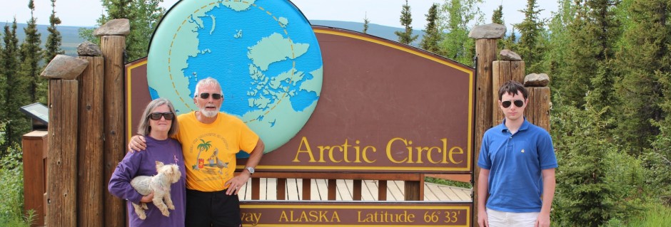
Amazingly, it only took eight months to connect Dawson Creek with Fairbanks, Alaska 1500 miles across mountains, tundra and great rivers. All this in a very remote and rugged area while dealing with temperatures 30 degrees below zero, arctic winds, and permafrost. The U.S. Army Corps of Engineers spearheaded this massive effort with nine regiments and thousands of civilians. Canada suspended all border control restrictions, taxes and tariffs. They provided the roadway easement, building materials and some civilian workers. In return, Canada was given the road at the end of the war. At the onset of construction, Dawson Creek exploded from a remote village of 400 to a bustling tent city of 10,000 within a few weeks.
In the forties, the “ALCAN Highway” had a gravel surface and an official permit was required to travel on it. Today, they let anyone willing to pay the high gas prices drive on it. It is now paved except for sections that might be under repair. I was on less than 25 miles that was not paved. The wildlife along some portions is phenomenal. I saw dozens of deer, three moose, a wolf, over 20 Stone Sheep, two wild goats, five black bears and one grizzly. There are also caribou in some areas but I was not close enough to positively identify them. Yesterday, I stopped so many times to take pictures and just watch game browse that I was 200 miles behind the previous day’s progress.
Whitehorse is an upbeat, progressive and clean little city with a rich and colorful past. This morning, 3 June, I linked up with Bill Quayle, my trip partner for the next 2 1/2 months. Bill arrived in Whitehorse the day before I did. Our scheduled meeting date was not until 5 June. Excitement was high as we went over our plans for the next few days. We made arrangements with Scott at Kanoe People, a local outfitter, to leave our gear in his fenced lot while we shuttle vehicles, etc.
The revised plan is for us to position most of our gear and both canoes with Scott for three days. During that time we will return my rental car to an agency in Skagway, AK, about two hours drive from Whitehorse, then we will hike from Skagway over the Chilkoot Trail to Bennett Lake. This is the famous route the gold seekers of 1897-1898 took after they got off ships in Skagway. They crossed the Coast Mountains through Chilkoot Pass, also through White Pass, and then down to the head waters of the Yukon River. They then made rafts and floated north down the Yukon to the goldfields of the Klondike and elsewhere. Fortunately, Bill and I will have our own canoes waiting for the trip down the Yukon and won’t have to do any raft building.
This was written by a driver on the Alaska Highway shortly after it was completed and before they rerouted some of it to make fewer sharp turns:
Winding in and winding out,
Filled my mind with serious doubt,
As to whether the lout,
Who built this route,
Was going to hell or coming out.
4 & 5 June Whitehorse, YT
The plan is being adjusted. After checking the conditions for crossing Chilkoot Pass, we have decided to do that after we canoe down the Yukon River. Snowshoes are recommended for over six kilometers on the top and north side of the Pass. We did not bring all the gear needed to safely make the crossing so we will check it again when we get back in September.
Yesterday and today we have been organizing our gear and picking up a few items we still need.
This evening we returned to the Klondike Rib & Salmon for dinner (we had lunch there yesterday). They serve many different types of wild game and Bill has been sampling some critters that are not available “down south”. Yesterday he had a muskox burger and tonight he dined on a bison steak. Meanwhile, I muddled thru with halibut yesterday and Arctic Char tonight, both were excellent. The Char was really special. Crystal served us yesterday and Donna tonight. We learned a lot about the local area from them. Donna and her partner, Treavor, are co-owners. Bill and I agree that, without exception everyone we have met in Whitehorse has been friendly, pleasant and most helpful; we like this place.
Tomorrow we will return the rental car to an agency in Skagway, AK and check out that town (it has a wild and bawdy reputation, so I’ll have to keep a close eye on Bill). Tomorrow afternoon, we will return to Whitehorse, visit a Laundromat and make sure we are ready for Scott, owner of Kanoe People Outfitters, to shuttle us to Marsh Lake. There, at the source of the Yukon River, we will start our journey to the Bering Sea.
On On!
6 & 7 June 2003
On Friday, 6 June, we drove 110 miles to Skagway, Alaska to return my rental car. Bill drove his truck over also, so he could give me a ride back to Whitehorse. The views crossing the Coast Range were great and we saw a beautiful large caribou.
This morning, we were shuttled to Marsh Lake, which folks here consider the source of the Yukon River. Mike from Kanoe People Outfitters hauled us, Bill’s canoe, and a very minimal amount of gear, to a bridge on M’Clintock Creek where we put in. Mike snapped a photo of us and we were off on our great (for us anyway) adventure. The Creek flows into M’Clintock Bay which enters into Marsh Lake. There are a few vacation homes on the Bay and they have marked the narrow channel out into the lake to keep their larger boats from running aground. In all the enthusiasm of the moment we paddled along their markers into Marsh Lake. As we entered the Lake, Bill was disappointed that we were heading into the wind and could not sail. He wanted to use his boat today just so we could sail on the lakes and wider parts of the Yukon. I was concerned that the direction seemed odd but knew that on twisting lakes and rivers we would be heading in every direction at some points. When I asked to take a short break to consult my compass, Bill said he thought our heading was suspect and checked his map. After about 5 seconds of confirmation, we executed an abrupt “about-face”, had the wind at our back and hoisted the sail. Bill was happy.
It was great sailing along on pristine Marsh Lake and into the Yukon River. The weather was sunny, about 65’F, and ducks, geese, terns, eagles and robins were on the shore and on sandbars. If the wind would slack a bit, we would paddle but keep the sail pushing as much as possible. Bill, in the stern, would hold the tiller with his knee and keep tension on the boom line by holding it in his mouth. This kept his hands free to paddle. We continued like this for about three hours, sometimes sailing, sometimes paddling and sometimes both. A few times I quickly glanced over my shoulder and saw Bill fully occupied, the line clenched between his teeth and a big grin on his face, he was loving it. In mid-afternoon, the wind shifted and as the river twisted the wind was on our nose. We finally took down the mast and resigned ourselves to our kayak-style paddles. Soon Bill commented that he had a severe pain at the back of his neck and through his shoulders. Now with a constantly stiff wind in our teeth, the paddling required more effort. Despite the agony, he never stopped paddling. For six or seven hours we pushed into a headwind, finally we slipped into the narrow Miles Canyon. This slot with high sheer walls on both sides leads into Schwatka Lake then at the north end of Swhwatka is a dam for Yukon Energy’s power generation plant at Whitehorse. It was good to know that we only had a few miles to go, but we knew the quarter mile portage around the dam and long fish ladder would not be easy for Bill. He was unable to lift even a water bottle when in some positions, but he’s a trooper and we soon had the loose items moved. His canoe is heavier than most and, without a carrying yoke is unwieldy for one person to carry. At Bill’s insistence, I lifted the bow high enough he could step under and rest it on his shoulders then I placed the stern on my shoulders and off we went. With Bill’s face inside the very point of the bow of the upside down canoe, he could only see his feet. I had a bit better range of vision and could see almost ten feet in front of Bill. With me giving him small course corrections we made the portage and went down the rocks to a place we could put in again.
The Yukon is much swifter after the dam and even with a strong headwind we quickly shot through Whitehorse to our take out point at Kanoe People Outfitters. It was 10 PM and it was the best of days and the worst of days, our first day was over.
8 & 9 June, Day 2 & 3
We rested on the 8th to let Bill’s pinched nerve continue to improve. We used the time to visit a laundromat, use the library computer and organize our gear. We topped the day off with our third meal at Klondike Salmon & Rib Bar-B-Q. I had the Arctic Char again and Bill had another Bison Steak.
This morning, we were waiting at Kanoe People Outfitters when they opened. We loaded our canoes, mailed off some film and information for the website to Betty, and were ready to leave at about noon. Scott took some pictures and we were on our way. The swift current quickly whisked us out of Whitehorse. It was a perfect day; the weather, sky, and river were all great. We rode the current, paddling only part of the time.
After a couple of hours, we met a German couple in a tandem kayak. Kristine & Frank were from Munich and plan to paddle to Carmacks, about 6 days down river. Soon there were some dogs barking on the shore. A man walked to the water’s edge and shouted for us to pull in. I was closest and quickly paddled to him, Bill was already past so it was best for him to keep going. The German couple said they had a tight schedule and passed. I talked about 15 minutes with a crusty old river runner, Ben Learmont from Vancouver. He said he had over ten thousand miles on the Yukon, and had gone to the Bering Sea years ago with his ten-year-old son. He yelled so much at his son who was sitting in the bow, that by the time they finished the son thought his name was “Paddle”. Ben is 68 years old and was very helpful. He already knew we were coming down river and had been waiting for us to come by so he could tell us about the trip. Ben gave me a very detailed and laminated map that he had made. It covers the route from Whitehorse to Dawson City. We shook hands, he wished us luck and I pushed off to catch up with Bill. Just a short way around the corner, Bill was fishing as he waited for me.
Eagles, gulls and clear, swift water filled the day. We made camp on Raymonds Island. We made 22 easy miles in half a day. After dinner, the wind increased and we turned in about 8 PM. Bill had put up his larger North Face tent which can withstand nearly 100mph winds. I used my little backpack tent, a Sierra Designs “Clip Flashlight” and the wind was really whipping it around. Just before I went inside, I spotted a kayak in the distance out on the choppy river. As I stood on the shore, a tandem kayak came to the bank, two Swiss men were on their way to camp at Lake Laberge for the night. As I watched them paddle off, bucking into the chop and wind, I was glad to crawl into my wind whipped, but warm, tent. It was a good day.
10 June, River Days-3/Total-4, 18 Miles Today/Total-67
As we walked around camp this morning a couple of upset seagulls made repeated aerial attacks on us. It was like something out of the Hitchcock movie “Birds”.
After 5 miles on the river, we entered Lake LaBerge (yes, the same as Lake LaBarge in Robert Service’s “The Cremation of Sam Magee”). We lost the main channel as we entered the Lake and had to drag our canoes across about a half-mile of sandbars. Lake LaBerge is beautiful, it is 30 miles long and 5 miles at its widest point, low mountains line both sides and the water is clear and cold. We camped on the eastern shore about half way up the length of the lake. The campsite is rocky, but very nice with a great view of the mountains on the western shore and a gorgeous sunset. Today we saw no other boats and had no civilization noise, not even an aircraft. We’re loving it!
“Till I came to the marge of Lake LaBarge and a derelict there lay.
It was jammed in the ice, but I saw in a thrice, it was called the Alice May.”
Robert Service’s “The Cremation of Sam Magee”
11June, Day-4, Total-5; Miles-23, Total-90.
Another great day! Bill was all packed and had coffee ready by the time I arose at about 5:30. This beautiful lake and the mountain views just captivate both of us. Again today there was no wind, that is great for me paddling on a large lake. However, Bill brought his sailing rig and has been disappointed that there has been no favorable wind. Since Bill’s canoe (without sailing) is slower than mine, we decided that he would depart and I would enjoy the campfire he had going and pack my gear. Too soon, it was time to leave this special spot. I was an hour behind Bill but we still had 16 miles of lake paddling and we knew from yesterday that I would most likely catch up in about 4 hours. The paddling, the lake and everything about this day were absolutely glorious. Soon, there was a white speck on the horizon in front of me. With the hint of a light wind, I knew it was Bill trying to sail again. A couple of hours later, I caught up with him and we easily paddled along together chatting and enjoying every minute. At the north end of the lake we were unable to spot the discharge point where the Yukon again becomes a river. We detected a slight current and followed it through some shallow sandbars and rocks. Finally, we saw the start of the River turning right and we were on our way again. We glided by the remains of the Casca, a paddlewheeler of days gone by. The River, at this point, is clear and swift and beautiful. A wilderness setting can surely get no better. Six miles or so zipped by, Bill saw an island on the map at U.S. Bend and we thought it would be a good campsite. Minutes later we spotted it, the water was lower than normal and the channel that would have made it an island was dry. We found it to be a great campsite; we pitched our tents in a little grove of fir trees. There were lots of wild onions between the shore and the trees. We both used them liberally in our evening meals. It was yet another great day.
12 June, River Days-5, Total-6; Miles-32, Total-122
This portion of the Yukon surely must be the best of the entire 2300 miles because it simply cannot get any better. The water is an aqua color and clear enough to see the bottom whiz by when it’s six feet deep. Every bend in the river displays a new vista of steep banks with mountains in the background. The current flows at about 5 mph much of the time, so the only paddling really required is to steer, however we do paddle a lot. The weather has been near perfect, high 30’s at night and 70’s during the day usually with a few scattered clouds.
As we came around a bend, a young buck (deer) climbed the bank and watched us drift by from his vantage point 30 feet above us. This afternoon, a cow moose trotted along the shoreline, following along behind her was a very small calf struggling to keep up. And eagles, we see them every day. Today one flew low overhead as if checking on us.
The old wreck of the original Klondike paddlewheeler is on a sandbar in the middle of the Yukon, as we were taking photos we darn near crashed into it. The Teslin River joined the Yukon and increased its width by about 50%.
I filled my solar shower bag earlier and laid it on top of the canoe deck to heat in the afternoon sun. Tonight we are camped on the open shore of the River. After pitching the tent, I went down to a point of gravel along the water and bathed with the preheated water. I asked Bill if he would like to use the remaining warm water. He said he would just wash off in the River. He stood in about one foot of water and washed; this water cannot be over 40 degrees, if that. Bill built a bigger fire than usual and we sat by it, clean, eating dinner, watching the Yukon roll on and wondered how we could be so fortunate.
13 June, Day-6, Total-7; Miles-50, Total-172.
Yet another great day on a great river in the far North. Only minutes after we were on the river, an eagle circled low over my canoe. It went around three times and as I watched this regal display with my binoculars, the telescopic eagle eyes were riveted on me. Much later in the day, I saw two more, but no circling.
We stopped at an abandoned Indian village called Big Salmon, a few deteriorating old log cabins with some furnishings, stove, tables, etc. were all that was left. A few prairie dogs are the only current residents.
Later we passed an old dredge on a sandbar. It was a homemade contraption floated in from Whitehorse in 1940. Two guys used it to dig up gravel and separate out the gold. They accumulated 72 ounces the first summer and never came back, leaving the dredge beside the River.
Late in the afternoon, we saw another cow moose trotting in the water along the shoreline, two tiny calves were following this big momma.
Our campsite tonight is at the inlet of Claire Creek and is picturesque. Our tents and campfire are on a twenty-foot high bank overlooking both the Yukon and Claire Creek. Snow still lines the banks of the little brook and at two points long snow “bridges” cover the flowing stream. We will replenish our drinking water from this clear source.
Before dinner I washed my clothes. We ate by the fire and watched the big river flow by, neither of us saying much. Bill grunted “beautiful” a couple of times and I mentioned that we saw no boats, no people and no planes today. Can it get any better?
14 June, Day-6, Total-8; Miles-42, Total-214.
We hated to leave our perfect campsite but the river is moving on and we need to be on it. Since Bill’s canoe is slower than mine, he departed about a half-hour before me. This is kind of pleasant, it gives each of us time to be alone on the river, go at our own pace, and enjoy the nearly silent wilderness around us.
In late morning, just before catching up with Bill, I passed Little Salmon Village. This unique little place has miniature houses that First Nation (Native Indians) relatives have built for family members who have gone to the “spirit world”. The colorful little houses are about 30 inches high and some are furnished with items that were treasured by the deceased.
We passed a couple from NC who were kayaking to Carmacks, about 30 miles down river. Bill and I chatted all afternoon and found a spot to camp on the downstream point of an island just a mile prior to reaching Carmacks. As we were finishing dinner, the NC couple paddled by. When they learned we were from Florida, they said they spend six weeks each year in the Everglades. Something clicked in my mind and we quickly asked their names, I think they said, Jack & Nancy Lamar. They were nearly out of shouting range when I asked if they knew my friend Jack Horner. Jack had told me about a couple that canoe & kayak lots of places and like to spend their winters working in Everglades National Park. I wished I had more time to talk with them, unfortunately, they are taking out at Carmacks about one mile downstream.
Today was overcast until about 7pm when the sun started peeking through the clouds. We did an easy 42 miles. Tomorrow is the day we will go through the Five Finger Rapids. Everyday we pass a lot of places with riffles and rocks to dodge occasionally, especially since the water level is lower than normal, but, Five Fingers is the only section really classified as rapids. I have read that they are usually Class 3 but it really depends on the conditions at the time. We do not expect them to be a problem.
15 June: Day-8, Total-9; Miles-38, Total-252.
Only a few minutes after launching, we put in at the public dock in Carmacks. This little village was named after George Washington Carmack, who, in 1896, with his two Indian partners, Tagish Charlie and Skookum Jim, made the first major discovery of gold on Rabbit Creek. The creek was later renamed Bonanza Creek and the great “Stampede” of gold seekers started to the Klondike. George Carmack started a trading post at the place now known as Carmacks.
It was about 7:30 on a Sunday morning when we arrived, but the little restaurant and the general store were open. I had a big breakfast and gathered some information about the town from some of the locals who were having coffee. The waitress, Alex, had only been there a couple of weeks. She is from southern BC and travels a lot. Probably in her 20’s she spent a year in New Zealand and has traveled all over Indonesia. We had a very pleasant conversation.
I was on the phone quite some time sending email journal entries and making calls. I was pleasantly surprised when I read a message from our daughter, Susan, wishing me a happy Fathers Day. I had no idea, it is easy to lose track of time when out of touch with the “other world”.
Bill found Jack & Nancy Lamar, the kayakers we saw yesterday. Later I talked with them also, a fascinating couple. They retired a year ago and are pulling a trailer while traveling around with their kayaks, bikes and backpacks. They are not the couple that Jack Horner told me about.
Bill and I both got some food items, especially fresh veggies, at the very well stocked general store, the only store in town.
Back on the river, the Five Finger Rapids were beautiful. The water was a little swifter with some haystacks but not at all difficult. Only a few miles down stream were the Rink Rapids. We knew that the old paddle-wheel companies had blasted a channel through these once very dangerous rapids. In both Five Fingers and Rink we stayed to the right side, as recommended and did fine.
Along the way we spotted a moose wading out of the water toward an island, a few minutes earlier I thought I saw something, through the binos, moving in mid-stream and discounted it as a tree or brush floating downstream. We also had the company of a beaver for several minutes. It swam away from the shore in front of Bill’s canoe then apparently decided it was too far across and reversed toward the shore but as the canoe got closer it turned back away from shore again. This reversal sequence took place three times before the poor guy slapped that big flat tail in the water and dove to the safety of the rocky shoreline.
Unfortunately, we spotted our first bear on the river. It had been dead for sometime and was on a gravel bar. It was bloated and most of the hair had slipped off. It was huge and “barely” recognizable.
We camped at an abandoned way station called Yukon Crossing. A hundred years ago, it was used as a stop for the stagecoaches going from Whitehorse to Dawson City. Passengers and drivers could eat, spend the night, get fresh horses, and load on a raft to cross the Yukon. Mother Nature is reclaiming the old log barn and log way station, but the walls are still intact and part of the sod roof is still on the barn.
During the night, I had stomach cramps and had to make unscheduled trips into the bush. Don’t know the cause, maybe some of the fresh produce I picked up in Carmacks or the water I loaded up back at Claire Creek. It was such a pristine and remote stream that I did not treat the water. Bill had no problems but he said his family is very resistant to such problems; I usually am.
Bill is a very good partner for this type trip. He is an experienced back-country camper and canoeist, self-reliant, strong as a bull, tough as nails, very aware of his surroundings and never complains. If he were female and a lot better looking it might be perfection. Bill and I were friends in high school, then went our separate ways. I had forgotten how he lives life with such gusto. He has a profound way of making emphatic comments that might be mistaken as carping when it is really this “animal’s” joy for life bubbling over. We both view life much the same, he is just more exuberant. It is good to have a life long friend along on the trip of a lifetime.